HISTORY OF THE DEPARTMENT OF GEODESY, CARTOGRAPHY AND CADASTRE
The Department of Geodesy, Cartography and Cadastre of the Technical Faculty of Urgench State University named after Abu Rayhon Beruni was established within the structure of the Department of Geography. From 2011 to 2020, the department was headed by Candidate of Geographical Sciences, Associate Professor Sattarbergan Avezov. During this period, along with the increase in the scientific potential of the department, new opportunities were created: admission to master’s programmes in Geography and in Geodesy and Cartography, admission to basic doctoral studies, provision of the department with modern laboratory equipment, and significant expansion of the department’s staff.
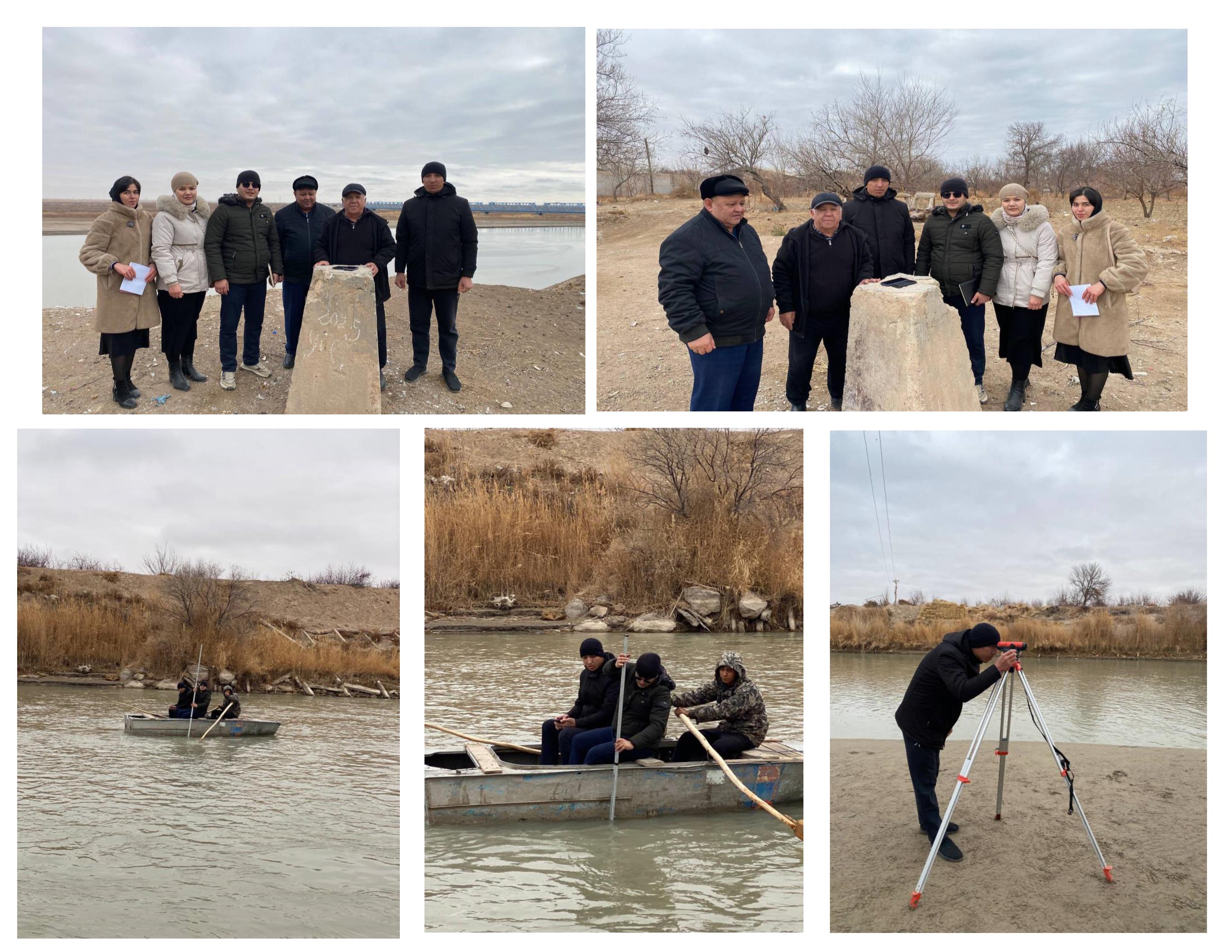
With the supply of geodetic instruments and equipment based on modern technologies, wide opportunities were created for performing cartographic work. Since 2013, the department has obtained a license for “Cartographic Works” issued by the State Committee of the Republic of Uzbekistan for Land Resources, Geodesy, Cartography and State Cadastre.
From the 2013–2014 academic year, bachelor training in the field 5311500 – “Geodesy, Cartography and Cadastre”, which was new for the region, was launched at the department. Since 2015, the department has been renamed the Department of “Geodesy, Cartography and Geography”.
From the 2023–2024 academic year, on the basis of the Department of “Geodesy, Cartography and Geography”, two separate departments — “Geography” and “Geodesy, Cartography and Cadastre” — were established, and Candidate of Geographical Sciences, Associate Professor S.A. Avezov was appointed as the head of the department. At present, about 20 professors and teachers are working at the department.
Since that period, the department staff has been conducting scientific research on the topic “Effective use and management of the resources of the Lower Amudarya region based on geodetic, cartographic and geophase technologies.” Within the framework of this topic, year by year, the scientific activities of the department members developed and the scientific potential increased significantly. In 2024–2025, Gulimmatov Ikrom Bakhtiyarovich, a teacher of the department, successfully defended his PhD dissertation in geography under the supervision of Candidate of Geographical Sciences, Associate Professor Sattarbergan Avezov, on the topic “Using modern methods in studying settlements of the Khorezm region.” In 2025, Associate Professor Murodjon Sultanov Qilichovich successfully defended his DSc dissertation in the specialty 11.00.06 – Geodesy, Cartography, under the scientific supervision of Professor E. Safarov, on the topic “Scientific and practical foundations of modelling agricultural crop yield using geoinformation algorithms, aerospace and cartographic methods.” In addition, Qalandarov Umarbek Samandarovich successfully defended his PhD dissertation in the specialty 11.00.06 – Geodesy, Cartography, on the topic “Using modern cartographic and geodetic methods in the rational placement of rice fields (on the example of the Khorezm region).” Furthermore, Associate Professor M.J. Matchanov successfully defended his DSc dissertation under the supervision of Professor A. Nigmatov on the topic “Natural-geographical assessment of ecological safety of the Khorezm oasis based on geophase technologies (on the example of the territory of Uzbekistan).”
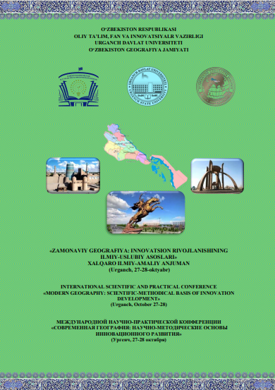
On 26–27 October 2024, an international scientific-practical conference titled “Modern Geography: Scientific and Methodological Foundations of Innovative Development” was held at the department.
Activities such as preparing scientific and educational grant projects, concluding economic contracts, and working on major fundamental and innovative projects also expanded at the department.
To date, research has been carried out and continues within scientific-technical, fundamental and applied innovative projects by the professors and teachers of the department.
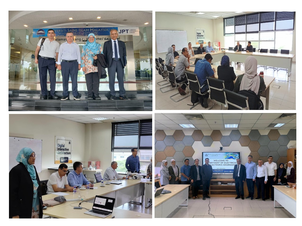
Within the framework of the European Union’s Erasmus+ programme, the project “Environmental protection in Central Asia: mitigating the negative impact of natural disasters through spatial research”, covering the years 2017–2021 with a total value of 911,576.80 euros, was successfully completed. Within the project, cooperation was established with leading universities of Sweden, Portugal, Greece and Lithuania.
Associate Professor M. Sultanov is conducting postdoctoral research within the international scientific project Between Europe and the Orient – A Focus on Research and Higher Education in/on Central Asia and the Caucasus, in the direction “Environment, natural resources, and renewable energies – Interdisciplinary transboundary research on human-environmental interactions”, on the topic “Optimization of Crop Modeling using synthetic high-resolution time series (OPCM)” in cooperation with the Department of Geoecology of Martin Luther University Halle-Wittenberg in Halle.
Based on the accumulated results and the requirements of the time, publications in prestigious foreign scientific journals, participation in international conferences, and the creation of a new generation of educational and methodological manuals are being implemented. In particular, methodological manuals such as “Web Cartography”, “Performing angle and distance measurements on the electronic theodolite VEGA TEO-5B”, “Recommendations on ensuring ecological safety in the Khorezm oasis”, and guidelines on using GeoJSON layers in teaching the topic “Working with symbols and geometric figures in an interactive map” were published. In recent years, the monograph “Modern geographical methods for studying soil salinization in the Khorezm region” authored by M.Q. Sultanov, E.Y. Safarov, S.A. Avezov and T.R. Matqurbonov was also published.
Currently, training of specialists in three bachelor’s degree programmes — 60722500 “Geodesy, Cartography and Cadastre”, 70721501 “Geodesy and Geoinformatics” and 60721700 “Cadastre” — has been established in both full-time and part-time forms. More than 250 students study in the full-time programmes, and about 300 in the part-time programmes. Since the 2020 academic year, admission to the master’s programme 70722502 “Geodesy and Cartography” has been carried out, and to date more than 20 specialists have been trained. Postgraduate education — basic doctoral studies (PhD) and doctoral studies (DSc) — is organized at the department, where doctoral students and independent researchers conduct scientific studies in the fields of geodesy and cartography.
At present, in order to further increase the scientific potential of the department, young scientists are intensifying their research and are preparing to defend their doctoral (PhD and DSc) dissertations. Doctoral students A. Adambayev and G. Rakhimova are continuing their research within basic doctoral studies (PhD).
Educational-methodological work is also carried out extensively at the department. Professors and teachers have prepared and published educational-methodological manuals and practical-laboratory materials in subjects such as Cartography, Geodesy, GIS, Photogrammetry and Remote Sensing.
In conclusion, it can be stated that the distinguished scholars working at the department continue to carry out consistent scientific research in the fields of geodesy, cartography and cadastre, in line with the requirements of reforms aimed at the socio-economic development of the Khorezm region, improving the living standards of the population, educating the younger generation and ensuring their employment in the context of globalization.